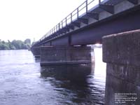
The Richelieu River is a river in Quebec, Canada. It flows from Lake Champlain about 171 km (106 miles) north, ending into the St. Lawrence River at Sorel. It has a drainage basin of 23,400 km² (9035 miles²), of which 19,600 km² (7570 miles²) are in the United States, and a mean discharge of 330 m³/s (430 yd³/s). St. Jean, Chambly, and Sorel are important communities on its route.
The French explorer Samuel de Champlain was the first European to reach the mouth of the river in 1609. Already an important pathway for the Iroquois Indians, it soon became one for French traders as well. They built forts along its length: Fort Richelieu at its mouth, Fort St. Louis (or Chambly), Fort Ste. Thérese and Fort St. Jean on the way, and Fort Ste. Anne on the Isle La Motte in Lake Champlain near its source. Some early journals and maps refer to the lower river as the Sorel River. Formerly also called Iroquois River, its French name comes from Fort Richelieu, which in turn was named in memory of Cardinal Richelieu (1585-1642).
The Chambly Canal (9 locks) permits boats to bypass the rapids at St-Jean-sur-Richelieu and Chambly.The Piste cyclable du Canal-de-Chambly is a 20 km bicycle path that follows the towpath along the canal. The bike path is part of Quebec's Route Verte bicycle path network. The canal is a National Historic Site of Canada and is operated by Parks Canada.
The Champlain Canal and Lake Champlain form the U.S. portion of the Lakes to Locks Passage, linking with the Hudson River and allowing navigation using the Richelieu between the St. Lawrence River and New York City and the Erie Canal.
No comments:
Post a Comment